|
Part 9: Collecting Monitoring Data
Point Intercept Method
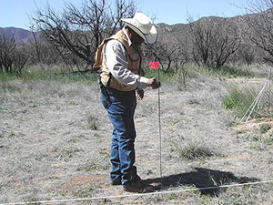
The Point Intercept Method is one of the most common approaches
to estimating cover. It is usually completed by placing quadrats
with an attached “pin” along a transect and determining
the proportion of points that “hit” (or intercept)
vegetation. This method can also be completed by walking along
a transect tape and recording the number of “hits” of
vegetation at the toe of your boot. Using this method, total cover
can be calculated as the percentage of hits, relative to the total
number of points sampled. Cover of individual species can also
be estimated by recording the plant species when intercepted by
a point.
It is important to have a complete photo record of the site taking
both general view and close-up photos. This method works for most
vegetation types, especially when less than 1.5 meters in height.
Plant height (shrubs) higher than 1.5 meters can make reading the
pin difficult.
Criteria
Guidelines should be determined prior to data collection. Here
are some examples:
- One ground cover hit (“positive” if the quadrat
pin is touching a plant and “negative” if the pin
is not touching a plant) is recorded per quadrat placement. The
total number of ground cover hits equals the total number of
quadrat placements.
- Bare ground is soil with particles up to ¼ inches,
gravel is particles ¼” – 3 inches, rocks
are particles greater than 3 inches.
- Litter is dead plant material directly covering the ground,
dead perennial vegetative bases, or animal material. If a small
stem or piece of litter is not considered large enough to intercept
raindrop impact, the hit is the ground covering below it.
- Persistent litter is considered ¼ inch thick. If
ground cover is less than ¼ inch, then it will be counted
as non-persistent litter.
- Annual forbs are considered non-persistent litter cover when
in contact with the ground and large enough to intercept raindrop
impact.
- Live vegetation is recorded when the frame point falls on
actively growing vegetation.
-
Alternative method
Equipment
Conducting the study and study sites
- When selecting key areas for setting up these quadrats, be
sure the site is located within a single plant community and
within a single ecological site.
- Data can be collected using any of the three layout designs.
- It is important to permanently mark each study location and
adequately describe the site on the Study Location and Documentation
Data form
- Be sure to establish a detailed photo record of the site
Study layout
- If you are using a baseline
layout, you should run several
transects perpendicular to the baseline. Linear and block layouts
can also be used.
- To ensure that both transects and quadrats are independent
(do not overlap), spacing between transects and between quadrats
should be greater than the average diameter of the largest plants
likely to be encountered.
Collecting Data
- At each pace along the transect (regardless of layout), place
the quadrat on the ground.
- Record the ground cover directly under or above the pin at
the base of the quadrat on the Cover Data form.
- Cover includes vegetation (can be identified by plant species
or simply as vegetation), litter, gravel, stone, or bare ground.
- You may simply record the presence or absence of vegetation,
although it is more effective to record the actual type of
ground cover if vegetation is not present.
Data Analysis
Calculate the percent cover for each transect by totaling
the “hits” for each cover component (vegetation,
litter, gravel, stone, or bare ground), dividing by the total
number of hits for the transect, and multiplying by 100.
- You can also calculate the percentage of each individual
plant species (species composition) by totaling the number
of “hits” for that species, dividing that number
by the total number of hits along the transect, and multiplying
by 100.
|
